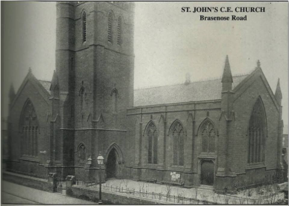
St. Johns Church Brasenose Road Bootle
-
Jan
- Posts: 6950
- Joined: Tue Mar 21, 2006 7:34 pm
- Location: Bootle
Hi Ourmaud,
Welcome to the site,
The records for St John's Brasenose Road are at Liverpool Records Office, in the temporary library in the museum in William Brown Street.
This is from their on line catalogue.
No 283 JBT
Title St John's Church, Bootle
Date 1827-1962
Description The collection comprises - Baptism registers, 1864 - 1942, Marriage registers, 1866 - 1945, Banns registers, 1940 - 1945.
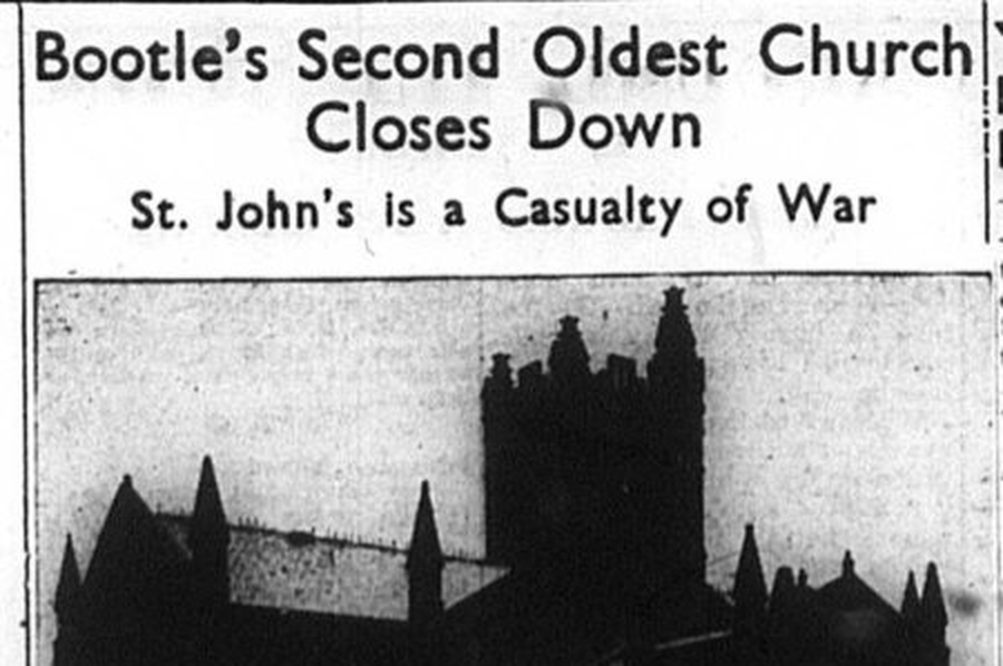
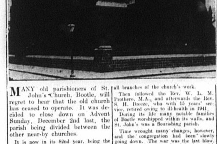
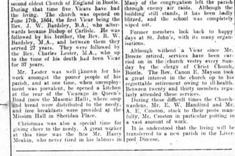
AdminHistory St John's '... Bootle's second oldest Anglican church' was licensed for the performance of Divine Service in June 1864. It was consecrated in November 1865 and assigned a parochial district in February 1866. The church stood on a site flanked by Brasenose Road and St. John's Road. During the Second World War St. John's church suffered from bomb damage to the extent that it had to be demolished. By order in Council its benefice was merged with that of St. Mary, Bootle in 1979 (see 283 BOO)
Extent 10 volumes
RelatedMaterial Records of St. Mary's Church, Bootle.
AccessConditions Access will be granted to any accredited reader.
Also the records for St James are at Liverpool.
282 JMB St. James Roman Catholic Church, Bootle 1845-1964
Consisting of baptisms and marriage records.
Jan
Last edited by Jan on Tue May 15, 2012 5:01 pm, edited 1 time in total.
Old genealogists never die......they just lose their census.
-
Jan
- Posts: 6950
- Joined: Tue Mar 21, 2006 7:34 pm
- Location: Bootle
Hi Ourmaud,
What years are you looking for for St John's?, there are some St John's registeres on the ancestry.co.uk website and a few other Bootle church records, they only go up to 1906 though.
Jan
Old genealogists never die......they just lose their census.
-
PETER CRAIG
- Posts: 2545
- Joined: Sun Aug 27, 2006 8:24 pm
- Location: BOOTLE
Welcome to the Bootle forum ourmaud,ourmaud wrote:Hi, i am looking for any info about the above church which was demolished after bomb damage, where are the records now located etc. Also anything about St. John and St James, Monfa Road -demolished in 2007.
Peter.
..
-
Dan

- Posts: 4730
- Joined: Sat Jul 07, 2018 6:24 pm
I'm not sure, but I think St John's is the church on the left of the picture, which was taken July 1936.
Brasenose Road is on the left, then St John's Road.
Further up ,on St John's Road, is the first St Alexander's church.
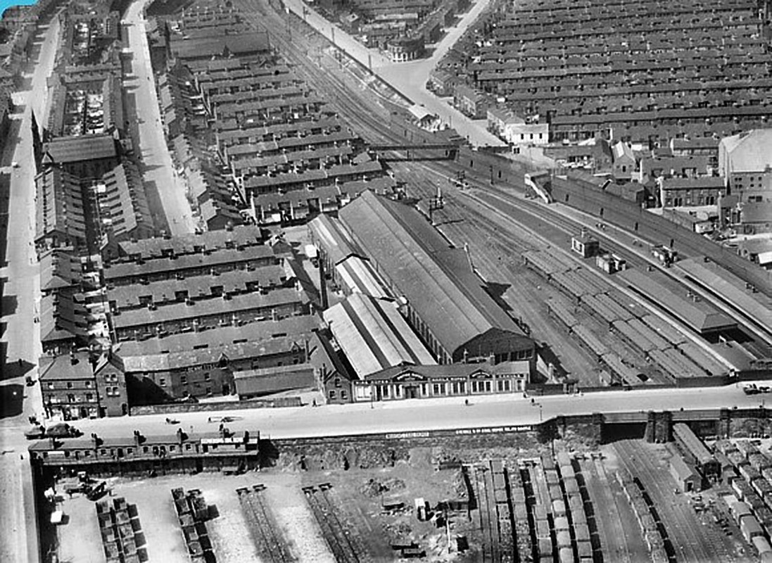
The street immediately behind the long rectangular British Ropes building, in the centre of the photo, is Hotspur Street.The next street is Glendower.
Just go through Shakespeare for the rest of the street names.
You can see the bridge over the railway, that had the really steep steps, leading down to the Glen.
The end house on St John's Road, on the lhs nearest to the camera, was Mrs Grogan's shop (in the 60s).
St John, Brasenose Rd., Bootle, L20 8HT
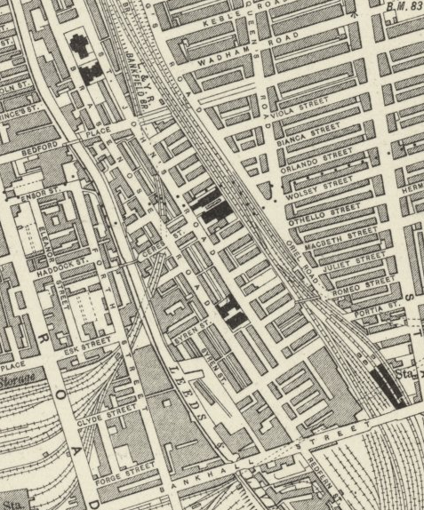
St John is located at OS Grid Reference - SJ 341941 .
This grid reference points to the church being in Ceres Street. But there's no church in the photo at this map reference.
Est 1827 - demolished after bomb damage.
Source: Liverpool Record Office
Map of area covered.
Regards
Dan
Brasenose Road is on the left, then St John's Road.
Further up ,on St John's Road, is the first St Alexander's church.
The street immediately behind the long rectangular British Ropes building, in the centre of the photo, is Hotspur Street.The next street is Glendower.
Just go through Shakespeare for the rest of the street names.
You can see the bridge over the railway, that had the really steep steps, leading down to the Glen.
The end house on St John's Road, on the lhs nearest to the camera, was Mrs Grogan's shop (in the 60s).
St John, Brasenose Rd., Bootle, L20 8HT
St John is located at OS Grid Reference - SJ 341941 .
This grid reference points to the church being in Ceres Street. But there's no church in the photo at this map reference.
Est 1827 - demolished after bomb damage.
Source: Liverpool Record Office
Map of area covered.
Regards
Dan