For any Old Dockers

Post your photo's and video memories about Bootle here...
Post Reply
User avatar
Dan
Posts: 4730
Joined: Sat Jul 07, 2018 6:24 pm

Expansion of the Panama Canal (2016).

Panama Canal Expansion Time Lapse 2011-2016. 5 years work in 2.5 minutes. Link below.

https://www.youtube.com/watch?v=loCQR8yt26w

Image

Image

Image

Image

Image

Image

Image

Isn't progress wonderful?

Regards

Dan
User avatar
Invicta
Posts: 2749
Joined: Wed Sep 02, 2015 6:46 pm
Location: Garden of England

These are the trains that pull the ships through the canal. K
Image
User avatar
Dan
Posts: 4730
Joined: Sat Jul 07, 2018 6:24 pm

Invicta wrote:These are the trains that pull the ships through the canal. K
Image
Cheers Ken.

In Bibby's we used to call that a bobby's job.Imagine the length of the queue for that train driver job.

Image

Regards

Dan
User avatar
Invicta
Posts: 2749
Joined: Wed Sep 02, 2015 6:46 pm
Location: Garden of England

Passing through the Panama Canal was the most interesting part of any cruise we’ve ever done.
I was on deck from 06.00 - 16.00 from Caribbean to Pacific , just fascinating. :D Ken
User avatar
Dan
Posts: 4730
Joined: Sat Jul 07, 2018 6:24 pm

From The Bootle Times December 28 1928, on 60th Anniversary of the Town Charter.

Image
Image
Image
Image

Regards

Dan
EdMcDonald
Posts: 1281
Joined: Tue Sep 16, 2008 4:09 pm
Location: Sherwood Park Alberta Canada

[quote="Dan"]Expansion of the Panama Canal (2016).

Panama Canal Expansion Time Lapse 2011-2016. 5 years work in 2.5 minutes. Link below.

https://www.youtube.com/watch?v=loCQR8yt26w

Image

Image

Image

Image

Image

Image

Image

Isn't progress wonderful?

Regards

Dancuote]

Not long returned from the Panama Canal cruise. San Diego to Maimi . Pretty impressive going through the locks and looking at the ship in front of you, which is about sixty feet higher than you. Cruise line served free champagne going through the locks. Can't remember going out the other side. :wink:
Home of the "Edmonton Oilers" Future Stanley Cup Champions. :D
A long way from Duncan B.C. :wink:
User avatar
Dan
Posts: 4730
Joined: Sat Jul 07, 2018 6:24 pm

Image

Picture showing St John's Lane/Roe Street junction with St George's Hall in the foreground and the Picton in the background.

Image

Regards

Dan
User avatar
Dan
Posts: 4730
Joined: Sat Jul 07, 2018 6:24 pm

1970s Knowsley Road.

Image

I came across this on Angelcake's twitter feed.

The first comment was from Gerard Garside (brothers Paul and Damian), more cousins, who lived at 292 Knowsley Road from 1946 to 1969. Mother and father Anne and Robert (known as Tiny).Uncle Bob was over 6 foot tall - them dockers and their nicknames- used to drink in the Pacific.

Gerard is on a couple of Tommy Howard's (Lancs 20) photos. I've downloaded most of Tommy's pictures into a folder- great photos of Bootle.

Regards

Dan
User avatar
Dan
Posts: 4730
Joined: Sat Jul 07, 2018 6:24 pm

Image

Image

Regards

Dan
User avatar
Dan
Posts: 4730
Joined: Sat Jul 07, 2018 6:24 pm

The card says Liner but it looks like the Isle of Man ferry to me.

Image

Woodside Birkenhead.

Image

Regards

Dan
john j connell
Posts: 1249
Joined: Fri Mar 27, 2009 11:18 pm
Location: The Fourth Grace.

Dan wrote:The card says Liner but it looks like the Isle of Man ferry to me.

Image

Woodside Birkenhead.

Image

Regards

Dan
Looks like the Carinthia (Cunard) to me, had a couple of uncles that worked on it in the 60s.JJC.
User avatar
Dan
Posts: 4730
Joined: Sat Jul 07, 2018 6:24 pm

Cheers John.

Couldn't make out the name, and I thought the logo on the bow looked like the Legs of Man.

Image

Regards

Dan
User avatar
Invicta
Posts: 2749
Joined: Wed Sep 02, 2015 6:46 pm
Location: Garden of England

Agree with John, Carinthia. Bonesy and I also had an Uncle who sailed on her.
I remember going to the Pier Head to see her, aged about 8.
Ken
User avatar
Dan
Posts: 4730
Joined: Sat Jul 07, 2018 6:24 pm

Well at least I called the front, the bow, Ken.

Regards

Dan
User avatar
Invicta
Posts: 2749
Joined: Wed Sep 02, 2015 6:46 pm
Location: Garden of England

The pointy end, Dan :D K
User avatar
Dan
Posts: 4730
Joined: Sat Jul 07, 2018 6:24 pm

Takes me back to my sea-faring days. About 5 days before the mast on Walton Hall Boating Lake.

Image

That was fun.

Regards

Dan
User avatar
Dan
Posts: 4730
Joined: Sat Jul 07, 2018 6:24 pm

1937 Landing Stage.

Image

1937 James Street Station.

Image

Regards

Dan
User avatar
Dan
Posts: 4730
Joined: Sat Jul 07, 2018 6:24 pm

Seaforth sands.

Image

1935 Lime Street.

Image

Regards

Dan
lynne99
Posts: 1206
Joined: Wed Jan 06, 2010 2:55 pm
Location: Rugby

All those people on Seaforth Sands. Any idea of when? Thanks for all the history you give us on various posts. Thanks Dan
User avatar
Dan
Posts: 4730
Joined: Sat Jul 07, 2018 6:24 pm

Lynne.

Not sure of the year but the map below was revised 1906/1907 and published 1909. I'm guessing the two buildings in the background may be Seaforth Hall and Portland House.

Image

Regards

Dan
User avatar
efc46
Posts: 416
Joined: Fri Oct 28, 2011 4:40 am

I remember getting on the ferry at the pierhead with me mates cross over the water hide in the toilets birkenhead side an back the pieread couple of trips an the crew men would say right next time we dock at the the pierhead off yeh get we never paid on the liverpool end only over the water( good day out)
Davey Rowlands Bootle
lynne99
Posts: 1206
Joined: Wed Jan 06, 2010 2:55 pm
Location: Rugby

Thanks Dan. I reconised Seaforth House from previous posts . So I think you are right. About 1900s Must have been a lovely day out.
User avatar
Dan
Posts: 4730
Joined: Sat Jul 07, 2018 6:24 pm

Landing Stage.

Image

Ferry Woodchurch.

Image

1923 Aerial view of the Pier Head.

Image

Regards

Dan
User avatar
Dan
Posts: 4730
Joined: Sat Jul 07, 2018 6:24 pm

1965 The Mammoth Crane.

Image
Image
Image
Image

Regards

Dan
Walsh
Posts: 105
Joined: Sat Feb 15, 2014 4:44 pm
Location: Southampton

Dan. Great to see the Mammoth Crane newsclip. As kids, we always looked at this working structure, in awe, as 'the largest example of real-life Meccano. Walshy.
User avatar
efc46
Posts: 416
Joined: Fri Oct 28, 2011 4:40 am

what a crane I always thought the germans stole it from the Dutch and the british claimed it as a war prize great story
Davey Rowlands Bootle
User avatar
Dan
Posts: 4730
Joined: Sat Jul 07, 2018 6:24 pm

Been looking at the 1881 Bootle Docks post on June 22 2014 from Tommy Howard (Lancs 20) .

I've enlarged, lightened and coloured them to identify the detail.

Image

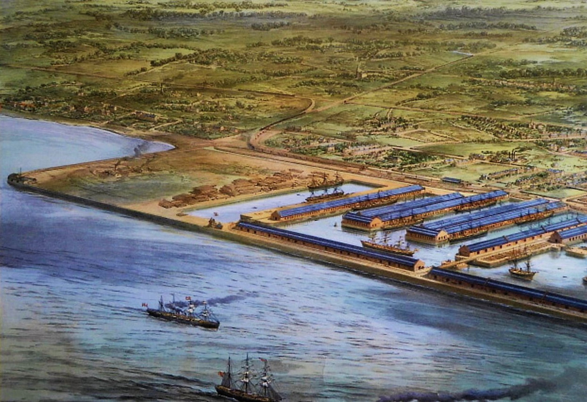
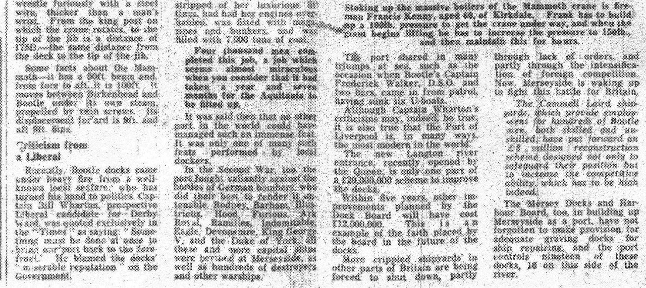
Seaforth Sands to lock gate of the Canada Dock, covering the Alexandra, Langton, Brocklebank (in front of Carrier North and Carrier) and part of the Canada.

The land behind the dock covers Seaforth, Crosby, Thornton, Litherland, Netherton, Orrell, Aintree and the heart of Bootle.

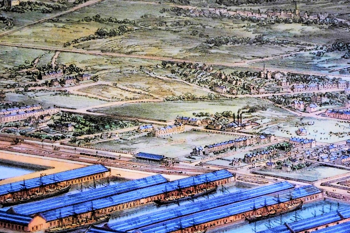
The later, detailed, photos pick out some of the major landmarks in the painting.


Image

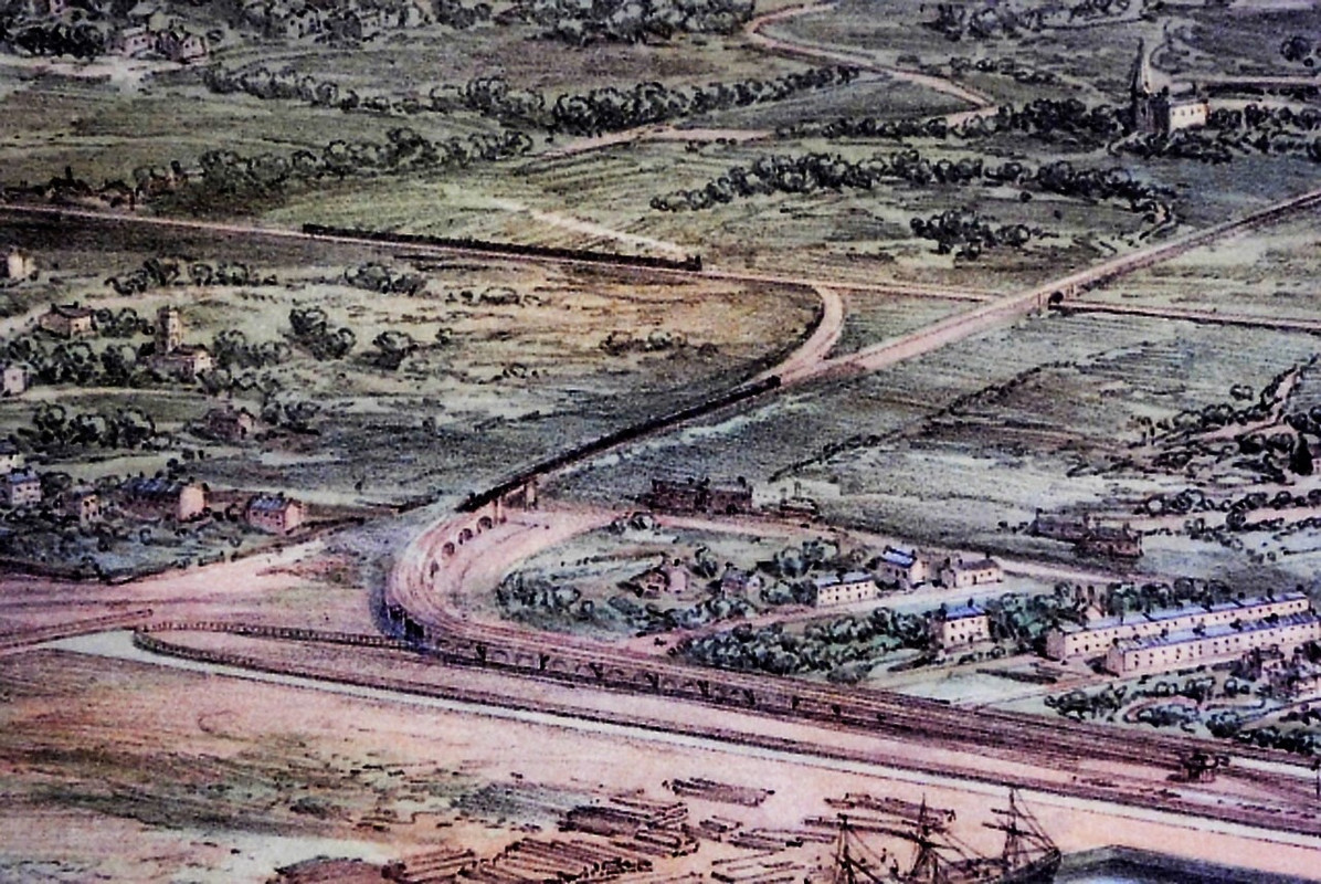
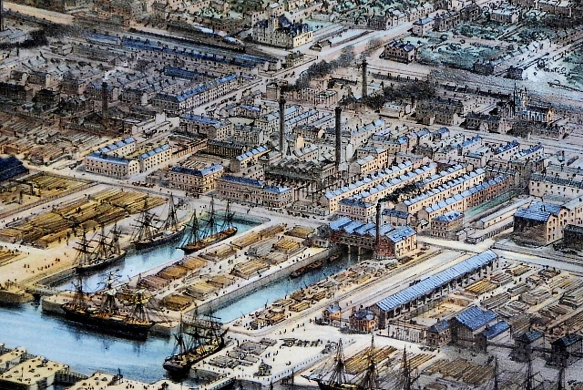
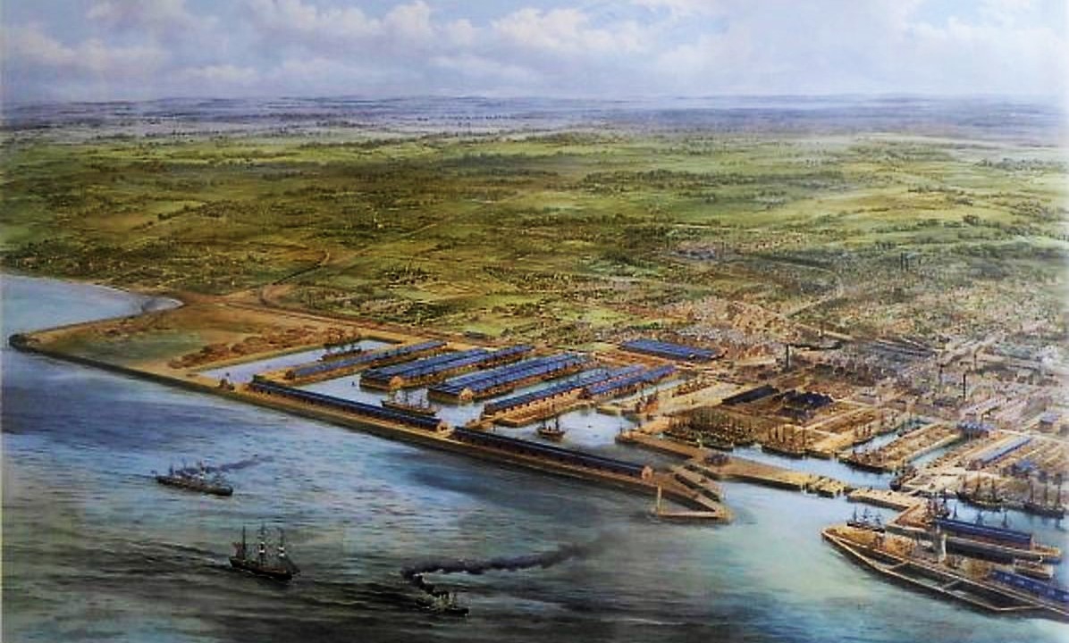
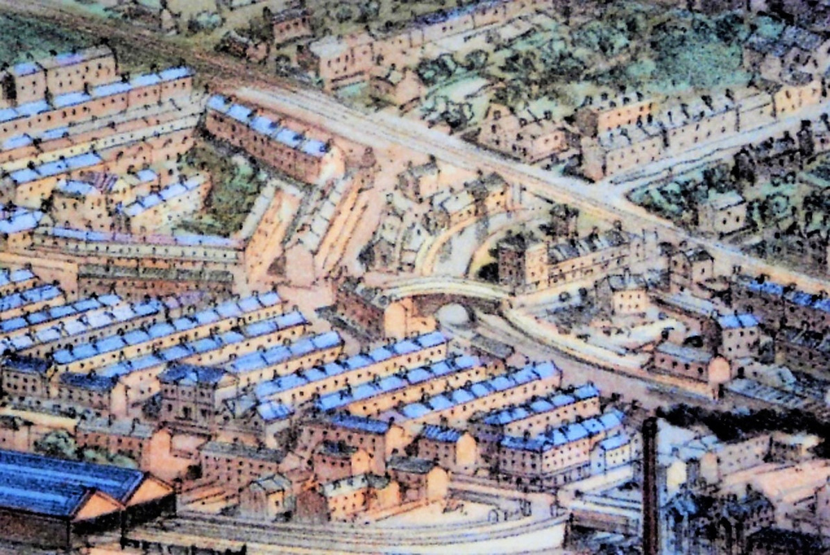
View of a little further south centred on the Brocklebank and Carrier Docks with central Bootle more visible.

The three long rectangular sheds just beyond the docks are the railway goods terminals that backed onto Church Street, adjacent to St Mary's Church.

Visible in the upper mid section are the Linacre gasometers, and to their right the hook in the canal as it leaves Bootle and heads to Litherland.

Just before the hook is where the Strand/Stanley Road Bridge stands today.

The dockside land shown approximately covers what would become Knowsley Road to Miller's Bridge/Balliol Road


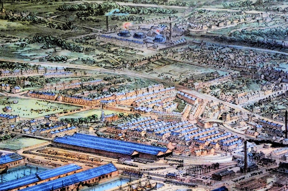
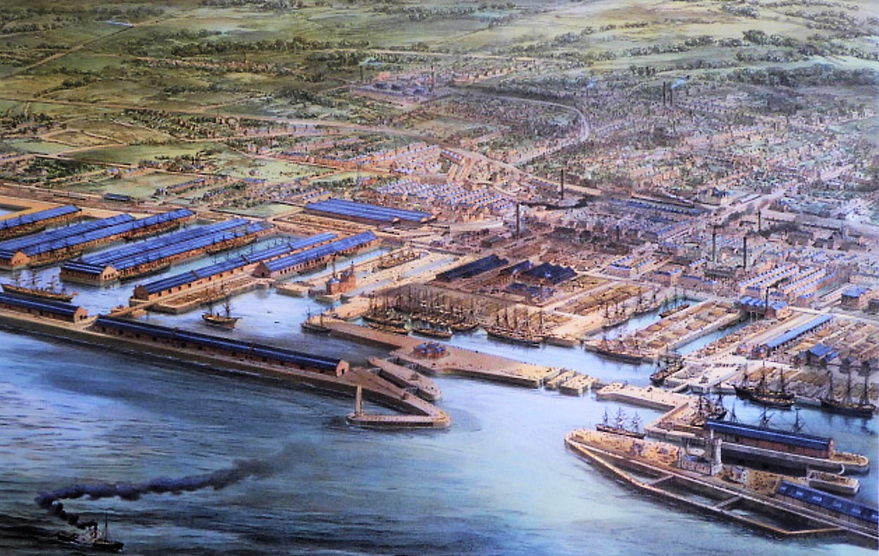
Detail from the second photo showing Linacre Gas Works and the canal.

Image


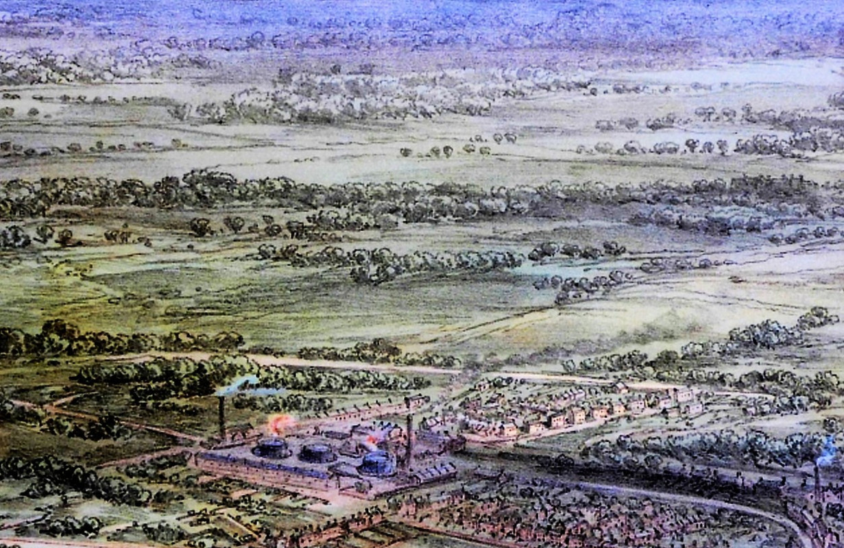
Detail showing Coffee House Bridge, above running from upper right to mid left is the Liverpool - Southport rail line.

Image

I'll post a bit more later.

Regards

Dan
User avatar
efc46
Posts: 416
Joined: Fri Oct 28, 2011 4:40 am

Thanks Dan very interesting /Davey
Davey Rowlands Bootle
User avatar
Dan
Posts: 4730
Joined: Sat Jul 07, 2018 6:24 pm

Cheers Davey, been going cross-eyed looking at the pictures then Ordinance Survey maps and back again.

Image

Above is a detail from the left side of the 1st photo, showing the area beyond Seaforth Sands in 1881.

The curved railway line, running from the docks, is the Fazakerley/North Mersey branch line.

The train cutting across the picture is the Southport - Liverpool train.

The church is St Philip's, named in honour Philip, The Earl of Sefton , who opened the church.

The canal will be in the picture somewhere. There's a line of three buildings then two buildings that may have stood on the canal bank.

The perspectives may be altered as it's a painting rather than a map.

No sign of the KFC or The Wispa.


Image

Above photo,lots of detail showing the Brocklebank with the Carrier North and Carrier Docks (the timber docks).

Millers Bridge and Balliol Road from mid left to upper right.

The Town Hall with the Liverpool bound train in front. Balliol baths not yet built.

There is a church to the upper right on the river side of King's Road, but I'm not sure what it was called.

Again, somewhere in amongst the buildings, the canal would be running between the docks and the Town Hall.

Regards

Dan
User avatar
Dan
Posts: 4730
Joined: Sat Jul 07, 2018 6:24 pm

Image

Main features, St Mary's Church and Linacre Gas Works.

The Liverpool - Southport railway line cuts through the heart of the photo.

The field adjacent to St Mary's, bordered by the Strand Promenade and Irlam Lane/Road, is the original ground of Bootle Cricket Club. A small crowd is on the field.

Part of the area is now covered by the old Bootle Fire Station.

Regards

Dan
lynne99
Posts: 1206
Joined: Wed Jan 06, 2010 2:55 pm
Location: Rugby

What a fantastic group of photos from the painting. Are there any other similar paintings? Thanks. I'mean still looking for Gascoigne St.
lynne99
Posts: 1206
Joined: Wed Jan 06, 2010 2:55 pm
Location: Rugby

Had to thank you again. What detail ,in a painting. Who painted it?
User avatar
Dan
Posts: 4730
Joined: Sat Jul 07, 2018 6:24 pm

No information available on the painting other than it's 38" x 26".


Regards

Dan
User avatar
Dan
Posts: 4730
Joined: Sat Jul 07, 2018 6:24 pm

Image

The road running from slightly upper mid right to the centre of the photo at Rimrose Road would be Marsh Lane.

Sandfield Park, the home ground of White Star Wanderers, was sited half way along Marsh Lane.

The Wanderers had major financial backing but never gained mass appeal ,though in the mid-1890s the Bootle Times would report them as being Bootle's premier football club. In 1895, a game against Birkenhead Locos drew a crowd of about 300 on a rainy Saturday afternoon.


Detail of the Marsh Lane area,

Image

Regards

Dan
User avatar
efc46
Posts: 416
Joined: Fri Oct 28, 2011 4:40 am

The 3 chimneys in the docks were they the 3 ugly sisters I have them in memory bank some were (i think my memory is not what it was that disease O.A is creepin up ) Davey
Davey Rowlands Bootle
Post Reply